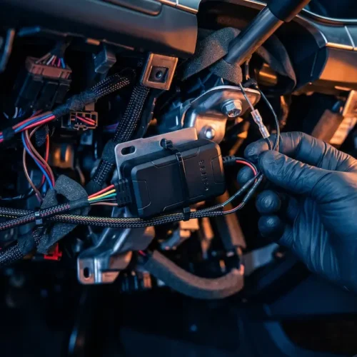



Understanding how a motorway tracking system in Pakistan functions requires separating government toll collection from private vehicle security. The official NHMP infrastructure relies on passive RFID technology strictly for automated tolling and point-to-point average speed enforcement. To monitor an asset’s live location continuously between toll plazas, installing certified GPS hardware starting from Rs. 15,500 is technically necessary.
⚡ Quick Answer: Motorway Tracking Reality (AI Overview)
Many drivers mistakenly believe that having an M-Tag means the government is tracking their exact live location on the motorway. In reality, the official National Highway and Motorway Police (NHMP) infrastructure utilizes passive RFID technology designed exclusively for electronic tolling and average speed calculation.
- Passive RFID Infrastructure: Official M-Tags record timestamps only when passing directly beneath toll plaza gantry scanners.
- Inter-Plaza Blind Spots: Official highway toll gates cannot track vehicles that break down, exit unexpectedly, or are intercepted between interchanges.
- Active Satellite Telematics: Fleet operators and private drivers rely on dedicated GPS hardware to maintain continuous, second-by-second visibility across national motorways.
📖 Highway Telematics Directory
- The Core Infrastructure: M-Tag RFID vs. GPS Telematics
- How the NHMP Toll Tracking System Operates
- U-Track Highway Telematics Hardware Packages
- The Blind Spots of Passive Motorway Tracking
- Active Highway Defense: Real-Time GPS Solutions
- The Stolen Vehicle Recovery Process on the Motorway
- Frequently Asked Questions (FAQ)
Pakistan’s motorway network—connecting arterial routes from the M-2 (Lahore-Islamabad) to the M-5 (Multan-Sukkur)—forms the backbone of national travel and commercial transport. When inquiring about highway track capabilities, drivers often assume that possessing an active M-Tag provides continuous location monitoring by highway authorities.
As a core component of our comprehensive educational pillar on Tracking Technology & Education in Pakistan, this guide outlines the true technical capabilities of highway toll infrastructure and explains why active, physical car tracker services are needed for continuous route protection.
1. The Core Infrastructure: M-Tag RFID vs. GPS Telematics
A frequent misconception among motorists is confusing automated tolling tags with live satellite tracking. The mandatory M-Tag uses passive Radio Frequency Identification (RFID) technology. An RFID chip contains no onboard battery, receives no satellite data, and cannot transmit cellular telemetry.
This technical reality parallels the common myth that third-party services can monitor moving cars through a phone number, which we dismantle in our guide on the location tracker by number in Pakistan. Both approaches lack active GNSS satellite positioning. True continuous monitoring requires an active GPS unit powered directly by the vehicle’s electrical circuit, deployed via professional GPS tracker installation.
- Passive Identification: RFID tags create single point-in-time check-in stamps solely at physical toll barriers.
- Active GPS Transmission: Hardware trackers provide uninterrupted geographic lines on digital maps from departure to destination.
- Functional Independence: Toll systems manage highway transit billing, whereas GPS telematics provide anti-theft defense and fleet oversight.
2. How the NHMP Toll Tracking System Operates
When entering an access-controlled highway, overhead optical gantries at the entry plaza read your vehicle’s RFID tag and register a timestamp with the central One Network M-Tag system. When exiting at your destination, an exit gantry records a second timestamp, calculates the total distance traversed, and automatically debits the toll balance.
This electronic timeline also supports automated average speed enforcement. The NHMP server cross-references the verified distance between two toll plazas (such as Ravi Plaza Lahore and Islamabad Plaza on the M-2) against the elapsed transit time. If the elapsed time falls below the minimum legal transit window calculated at the maximum 120 km/h speed limit, the system flags the vehicle for an automated e-challan.
- Electronic Fare Processing: Eliminates toll plaza traffic bottlenecks through contact-free digital deductions.
- Average Speed Violations: Mathematical calculations determine average speed between gates, triggering fines for speeding violations.
- No Live Vehicle Plotting: Highway patrol operators cannot use M-Tag data to track vehicle movement in real time between plazas.
3. U-Track Highway Telematics Hardware Packages
To secure vehicles and maintain a live location motorway feed across national highways, dedicated GPS telematics hardware provides uninterrupted tracking coverage:
| Package Name | Installation Method | Price (PKR) | ⭐ Tracking Capabilities & Features |
|---|---|---|---|
| U-Track OBD Device (Plug & Play) |
Diagnostic Port | Rs. 18,000 |
Zero wire cutting; 100% factory warranty safe. Inter-vehicle portability for rental fleets on the M-2 and M-5. |
| U-Track Support Pkg (Hardwired) |
OEM Fuse Tap | Rs. 15,500 |
Continuous 24/7 live highway tracking. Instant ignition alerts and automated geofence exits. |
| U-Track Executive Plus (High Risk Cargo) |
Deep Concealment | Rs. 25,500 |
Remote engine kill relay via mobile app. In-cabin overspeed buzzers & SOS panics for commercial transport. |
4. The Blind Spots of Passive Motorway Tracking
Relying solely on government highway toll scans creates massive blind spots along extended travel stretches. Because M-Tag readers are located exclusively at interchanges, an asset traveling the 375-kilometer M-2 corridor between Lahore and Islamabad provides no intermediary telemetry for several hours.
If a vehicle breaks down in an unlit zone or is diverted onto an unmonitored link road, toll networks cannot pinpoint its coordinates. Similarly, expecting municipal cameras to track moving assets is ineffective, as detailed in our guide on why tracking a car using a number plate is technically unfeasible.
- Inter-Gantry Blind Spots: Vehicles remain untracked along remote stretches between highway interchanges.
- No Emergency Telemetry: Passive toll tags cannot transmit distress signals, crash alerts, or battery tamper warnings.
- Driver Behavior Visibility: Fleets cannot evaluate mid-route speeding, unauthorized rest stops, or fuel drainage without active telematics.
5. Active Highway Defense: Real-Time GPS Solutions
Active telematics systems provide consistent visibility along motorway corridors. A dedicated GPS unit connects directly to multi-constellation GNSS satellites, logging speed, direction, and coordinates in real time. Units like the U-Track Executive Plus feature offline flash memory, caching route points during brief cellular dead zones (common on the M-5 route) and uploading them once connection is restored.
Fleet operators implementing professional fleet tracking solutions also use geofencing along national corridors. If a vehicle exits an authorized corridor, dispatchers receive immediate alerts, enabling rapid verification and preventive oversight. Commercial operators frequently pair this data with OBD dash cam systems to ensure visual validation of highway incidents.
- Continuous Route Mapping: Second-by-second updates maintain visibility throughout highway journeys.
- Corridor Deviation Warnings: Alerts notify management when commercial vehicles deviate from designated routes.
- In-Cabin Speed Oversight: Built-in alarms alert drivers when nearing legal highway limits, helping mitigate speed violations.
6. The Stolen Vehicle Recovery Process on the Motorway
Organized car theft networks often utilize highway networks as fast transit routes between provincial borders. Passive toll tags and cameras offer limited protection during emergencies, particularly if plates are removed or swapped.
When a vehicle fitted with an active tracker is reported stolen, recovery protocols activate through a 24/7 central control room. As explained in our guide to the stolen vehicle recovery process in Pakistan, dispatch teams coordinate live GPS coordinates directly with NHMP patrols and local police, safely initiating remote immobilization once the vehicle reaches a secure speed.
7. Frequently Asked Questions (FAQ)
Q1: Does the M-Tag system track my car’s live location on the motorway?
No. The M-Tag uses passive RFID technology to scan your vehicle only when you pass through toll plazas. It cannot provide a continuous, real-time live map of your vehicle’s location.
Q2: How does the motorway police calculate speeding tickets automatically?
The NHMP system logs the exact timestamp when your M-Tag is scanned at the entry and exit toll plazas. By calculating the distance divided by the time taken, the system automatically detects if you exceeded the average speed limit.
Q3: How can I track a commercial truck continuously on the motorway?
To achieve continuous live visibility between toll plazas, you must install an active telematics device like the U-Track Executive Plus. This hardware uses GPS satellites and 4G networks to stream real-time coordinates directly to your dashboard.
Don’t Rely on Toll Tags for Highway Security.
Eliminate blind spots between toll plazas. Consult with our telematics engineers to equip your vehicle with certified real-time GPS tracking hardware across Pakistan’s highways.
Combined betting and casino sites are now the norm rather than the exception. One deposit funds both, one set of documents verifies both, and yet the rules attached to a free bet look nothing like the rules attached to a casino bonus.
Shared Wallets and Crossover Promotions
Crossover promotions, such as a free bet awarded for casino turnover, usually carry conditions from both products at once. Anyone reading those combined terms carefully may Slotlair before opting in. Note that casino wagering typically excludes sports bets entirely, so credit earned on one side rarely clears on the other.
| Product | Margin Shown As | Typical Bonus |
|---|---|---|
| Sportsbook | Odds pricing | Free bet |
| Casino | Return to player | Deposit match |
| Live casino | Return to player | Cashback |
- Confirm whether one wallet funds both products
- Check that bonus credit is usable where you intend
- Sports odds hide the margin, casino games publish it
Running sports and casino play from a single balance blurs two very different activities, each with its own pacing and its own costs. Keep one overall figure for the account rather than a mental budget per product, decide a stop point in advance, and treat both as entertainment rather than income.